Digital models of public space should be public - and what you can do about it

Public space is great! Don’t worry, the next paragraph will be about OpenStreetMap. But only first an important trip to your neighborhood. Think about your favorite place there. What makes it special? For me it’s the market square a block down from where I live. In the evening people sit in front of the corner bar, sometimes a neighborhood club organizes a flea market, twice a week local farmers offer vegetables, eggs, cheese and meat, people play pétanque late into the night, the city has placed a public bookshelf on the square, which people fill with donated books. A lot happens on this small square, you feel life and a community here. Why is that? Anyone can use the space and everyone brings something to it: companies, clubs, people, the city.
That is special about a public digital space
And now let’s transfer this to digital realm: Are there digital maps with models of a public space similar to my market square? Digital representations of public space that anyone can use, enhance and edit? Free use is more than not-paid-for consumption in my view. Free use should be based on the same principles that make the market square on my block so great: Freedom to make, change, enhance, reuse and utilize.

OSM shows what is important to local volunteers. Closed, commercial and centralized maps show what is important to product managers and the business plan.
So what is the obvious difference between a closed and commercial and a public representation of the market square in my hood? OpenStreetMap shows the public bookshelf, the public banks, the farmers’ market, the bicycle stands and the recycling box. Google Maps does not show any of these.
The reason for this could be: Public bookshelves and benches do not matter as much for advertising and for product managers as they do for people who live near this square and map it in their free time.
This is an essential difference between the open, non-commercial OpenStreetMap model and closed and commercial mapmakers: design options and the freedom to innovate. OpenStreetMap show’s what is important to local volunteers and you can choose which of all that raw information you integrate with your version of OSM. Closed digital representations of public places show what is important to the company that controls the raw data on which the visualized map is based.
The point is: Digital models of public space should be public, too.
The second major difference between open and closed maps is the freedom for further use. Using data from OpenStreetMap everyone can develop navigation applications, infographics or visualizations of historical data based on very open licenses. Some examples:
- the base map of CartoDB uses OSM data (commercial service, free software)
- the data visualizer Umap is based on OSM data (free service, free software)
- Foursquare uses OpenStreetMap data (commercial service)
- the navigation application Telenav Scout is based on OSM data (commercial service)
The diversity of these applications and services based on OSM reminds of the diversity on my market square. Using the physical, public infrastructure everyone can try something new, individuals, clubs, companies, the city. The OpenStreetMappers are as free to be creative as people are in the public. This is different from commercial and closed map providers. That is why for me the use and promotion OSM is important (apart from the practical advantages): It helps to keep digital models of public space free and public.
Free volunteers fill information silos – or the commons
Now a higher abstraction level: I think the creation of digital maps and models of our physical world is a good example for a strong trend in the development of the entire net. Of course, users can complement and enhance almost any closed mapping application. Insert the opening times (Google Maps)! Correct maps (TomTom Mapshare)! Rate restaurants! Deliver real-time data about traffic jams (apps like Waze depend on the participation of users)!
But in these models the operators of the closed platform decide who can use, reuse, enhance and innovate based on the contributions of volunteers. That is the essential difference to the open and free model as seen in OpenStreetMap. The model of contribution to closed platforms drives many of the UGC-platforms mentioned in the “Internet Trends Report 2015” by investment company Kleiner Perkins Caufield & Byers. It states:
“Reimagining Content: It’s increasingly user-generated / curated & Surprising.” And: “Imagine that users Generating Their content are recreating Their internet.”
Of course KPCB mentions closed platforms such as Pinterest, snapchat, Twitch, Wattpad. They are based on the same commitment as a lively public space, but they only provide or simulate certain aspects of a public space. Like a shopping mall. The alternatives are commons like OSM.
What you can do now
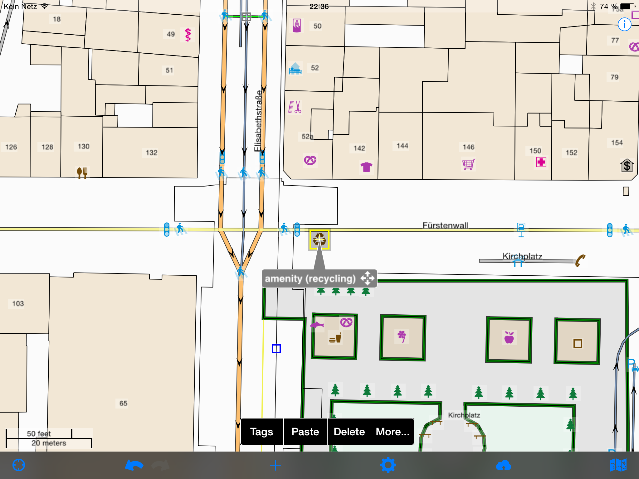
Take the second sentence in KPCB presentation seriously and change the internet. It’s very simple and there is an app for that: Install the outstanding OSM Editor Go Map on you iOS device and improve the largest public digital model of our physical world. Here are alternatives for Android, for PC and here is an introduction to getting involved. Add opening times! Map markets and public bookshelves! Update information on shops! Do it! Your smartphone is a perfect tool for this, it takes seconds, is fun and makes the world a better place. In the image below you see a recycling bin I mapped. That took about five seconds.


